#193: popes, usa centric, london, poverty, rivers
, last check: Thu, 30 Jul 2026. Post history
-
 popes
Maps of all trips of different popes
popes
Maps of all trips of different popes
https://www.washingtonpost.com/graphics/local/2015-papal-visit/pope-visits/ | archive.org -
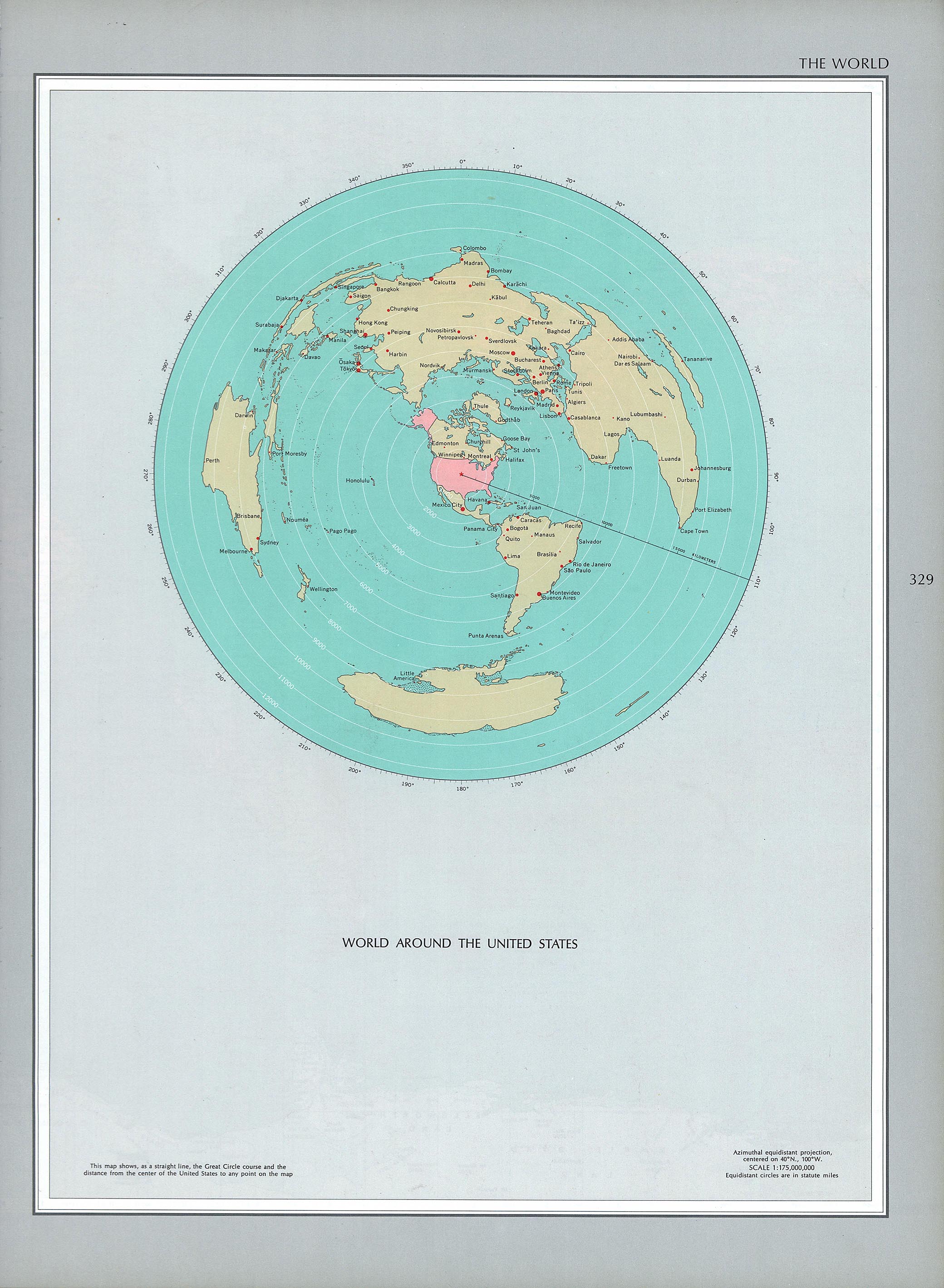
usa centric
The world around the United States of America plotted on an Azimuthal Equidistant projection
https://maps.lib.utexas.edu/maps/national_atlas_1970/ca000243.jpg -
london
Hand drawn illustrated maps of London and neighborhoods. Copies for sale
https://www.thisismikehall.com/london-maps -
poverty
Map of the poverty and social exclusion across Europe (page 10 of the PDF)
https://www.bbsr.bund.de/BBSR/EN/Publications/ResearchNews/2011_2015/2015_1.pdf | archive.org -
rivers
Interactive visualization with USA data of the hydrographic network
http://richiecarmichael.github.io/radial/index.html
Raf